学会・研究会
5/25 Mon
[H-TT09] GIS(国際セッション)
コンビーナ:*小口 高(東京大学空間情報科学研究センター)、村山 祐司(筑波大学大学院生命環境科学研究科地球環境科学専攻)、柴崎 亮介(東京大学空間情報科学研究センター)、吉川 眞(大阪工業大学工学部)
- 09:00 〜 09:15 [HTT09-01]
Rainfall conditions and magnitude of landslides in Taiwan
*CHEN, Chiwen; OGUCHI, Takashi
https://confit.atlas.jp/guide/event/jpgu2015/subject/02095/entries - 09:15 〜 09:30 [HTT09-02]
Representation of landslide events and DEM sensitivity in relation to landslide susceptibility analysis
*Uttam PAUDEL, Takashi OGUCHI, Yuichi S. HAYAKAWA
https://confit.atlas.jp/guide/event/jpgu2015/subject/03258/entries - 09:30 〜 09:45 [HTT09-03]
Analysis of the landslides in Hiroshima caused by the typhoon-12 based on bivariate statistical landslide susceptibility
*Jie Dou, Uttam Paudel, Takashi Oguchi, Yuichi S. Hayakawa
https://confit.atlas.jp/guide/event/jpgu2015/subject/03894/entries - 09:45 〜 10:00 [HTT09-04]
Delineation of karst depressions using different digital elevation models
*Hao CHEN, Takashi OGUCHI, Pan WU
https://confit.atlas.jp/guide/event/jpgu2015/subject/02083/entries - 10:15 〜 10:30 [HTT09-06]
Evaluation of Erosion Rates on a Global Scale
*Hagar HECHT, Takashi OGUCHI
https://confit.atlas.jp/guide/event/jpgu2015/subject/02722/entries - 10:30 〜 10:45 [HTT09-07]
Developing a system of geospatial data sharing and visualization for disaster management in the Philippines
*Takashi OGUCHI, Hiroki KOBAYASHI, Yuichi S. HAYAKAWA, Toshikazu SETO, Yasuhisa KONDO, Rene Mendoza
https://confit.atlas.jp/guide/event/jpgu2015/subject/02576/entries - 18:15 〜 19:30 [HTT09-P01]
Simple Evaluation Method for Flood Risk Using Rainfall Intensity Data and Machine Learning
*Rina SATO, Takashi OGUCHI
https://confit.atlas.jp/guide/event/jpgu2015/subject/00158/entries
5/26 Tue
[H-TT08] Geoscientific applications of high-definition topography and geophysical measurements (国際セッション)
コンビーナ:*早川 裕弌(東京大学空間情報科学研究センター)、佐藤 浩(日本大学文理学部)、楠本 成寿(富山大学大学院理工学研究部(理学))、内山 庄一郎(独立行政法人防災科学技術研究所)
- 09:30 〜 09:45
[HTT08-03] Tsunami-induced bedrock erosion and sediment deposition on uplifted coastal bench: Cape Todogasaki, eastern Japan
*Yuichi S. HAYAKAWA, Hiroyuki OBANAWA, Patrick Wassmer, Hitoshi SAITO, Takashi OGUCHI
https://confit.atlas.jp/guide/event/jpgu2015/subject/02538/entries - 18:15 〜 19:30
[HTT08-P02] Ground surface deformation of small mud volcano by repeated measurements of terrestrial laser scanning (Murono, Japan)
*Yuichi S. HAYAKAWA, Shigekazu KUSUMOTO, Nobuhisa MATSUTA
https://confit.atlas.jp/guide/event/jpgu2015/subject/02678/entries - 18:15 〜 19:30
[HTT08-P03] High-resolution spatio-temporal topographic survey in hardly accessible sea cliff
*Hiroyuki OBANAWA, Yuichi S. HAYAKAWA
https://confit.atlas.jp/guide/event/jpgu2015/subject/03747/entries
[H-TT32] 地理情報システム
コンビーナ:*小口 高(東京大学空間情報科学研究センター)、村山 祐司(筑波大学大学院生命環境科学研究科地球環境科学専攻)、柴崎 亮介(東京大学空間情報科学研究センター)、吉川 眞(大阪工業大学工学部)
- 11:00 〜 11:15
[HTT32-01] 測量、地形学、GISの相互関係に関する歴史的考察
*小口 高
https://confit.atlas.jp/guide/event/jpgu2015/subject/03635/entries
- 11:30 〜 11:45
[HTT32-03] トルコ・カイセリ県における遺跡周辺の地形情報の取得と解析
*早川 裕弌、小花和 宏之、吉田 英嗣、鳴橋 竜太郎、奥村 晃史、財城 真寿美
https://confit.atlas.jp/guide/event/jpgu2015/subject/03020/entries
[H-GM02] Geomorphology (国際セッション)
- 18:15 〜 19:30
[HGM02-P01] Measurement of changes in wall surface morphology in Yoshimi-Hyakuana cave by terrestrial laser scanning
*Yuichi S. HAYAKAWA, Chiaki T. OGUCHI, Natsuki ARIGA, Hisashi AOKI
https://confit.atlas.jp/guide/event/jpgu2015/subject/02678/entries
[M-TT43] ソーシャルメディアと地球惑星科学
コンビーナ:*天野 一男(茨城大学理学部地球生命環境科学科)、小口 高(東京大学空間情報科学研究センター)、伊藤 昌毅(東京大学生産技術研究所)
- 16:15 〜 16:30
[MTT43-01] My JpGU:日本地球惑星科学連合会員のためのソーシャルネットワークサービス
*近藤 康久、小口 高、村山 泰啓、川幡 穂高
https://confit.atlas.jp/guide/event/jpgu2015/subject/01803/entries - 16:30 〜 16:45
[MTT43-02] 広く流布している地球科学に関連した誤解を解くためのソーシャルメディアの活用
*小口 高
https://confit.atlas.jp/guide/event/jpgu2015/subject/02075/entries
5/28 Thu
[M-GI36] 地球惑星科学におけるオープンサイエンスデータをめざして
コンビーナ:*村山 泰啓(独立行政法人 情報通信研究機構)、小口 高(東京大学空間情報科学研究センター)、近藤 康久(総合地球環境学研究所)、古村 孝志(東京大学大学院情報学環総合防災情報研究センター)、金田 平太郎(千葉大学大学院理学研究科 地球生命圏科学専攻地球科学コース)、坂口 有人(山口大学)、篠原 育(宇宙航空研究開発機構/宇宙科学研究所)、横山 央明(東京大学大学院理学系研究科)
- 15:10 〜 15:25
[MGI36-04] 個人研究者が作成したデータを共有するための東京大学空間情報科学研究センターの活動
*小口 高, 早川 裕弌, 桐村 喬
https://confit.atlas.jp/guide/event/jpgu2015/subject/02221/entries
[S-SS28] 活断層と古地震
- 3:15 PM – 3:30 PM
[SSS28-23] Offset clusters on the Haiyuan Fault and its implications to earthquake rupture pattern
*Zhikun REN
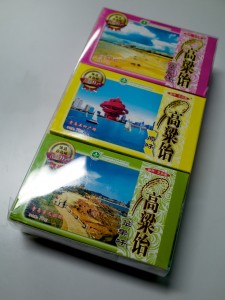
山東省の飴といえば高梁飴。青島でのACOST-4に参加された小口さんより。
学会の様子はこちら→
http://blog.163.com/yonghongwangg@126/blog/static/1323621132014827111359304/
Asia Oceania Geosciences Society (AOGS) 11th Annual Meeting
Jul. 28 (Mon)
Oral session SE05 Advances in Mapping and Modeling Rainfall-Triggered Landslides
- SE05-A005
Hitoshi SAITO, Oliver KORUP, Taro UCHIDA, Shin-ichiro HAYASHI, Takashi OGUCHI
Rainfall conditions, typhoon frequency, and contemporary landslide erosion in Japan.
Oral session IG12 Geomorphology and Recent Geospatial Technology
- IG12-A012 (IG12-D1-AM2-EB-001)
Yuichi S. HAYAKAWA, Fumitoshi IMAIZUMI, Norifumi HOTTA, Haruka TSUNETAKA
Terrestrial Laser Scanning and Structure from Motion for Analysis of Landform Changes by Debris Flows in Ohya-kuzure Landslide, Central Japan. - IG12-A002 (IG12-D1-AM2-EB-003)
Rina SATO, Takashi OGUCHI
Topographical Characteristics of Flooded Areas for Evaluating Risk of Pluvial Flooding. - IG12-A005 (IG12-D1-AM2-EB-005)
Hao CHEN, Takashi OGUCHI1, Pan WU
Assessment of Soil Erosion Rate in a Karst Basin of Southwest China Using RUSLE and GIS.
Jul. 31 (Thu)
Poster session IG12 Geomorphology and Recent Geospatial Technology
- IG12-A001 (IG12-D4-PM2-P-007)
Chi-Wen CHEN, Takashi OGUCHI
Rainfall Intensity-duration Conditions of Mass Movements in Taiwan. - IG12-A003 (IG12-D4-PM2-P-008)
Jie DOU, Takashi OGUCHI, Yuichi S. HAYAKAWA, Shoichiro UCHIYAMA
Integrated Use of Certainty Factors and Frequency Ratios for GIS-based Evaluation of Earthquake-induced Landslides in Central Japan. - IG12-A007 (IG12-D4-PM2-P-009)
Uttam PAUDEL, Takashi OGUCHI
Comparative Analysis of the Implementation of Random Forest for Studying Landslide Susceptibility in Japan. - IG12-A009 (IG12-D4-PM2-P-010)
Miki OKANO, Takashi OGUCHI
Geomorphological Analyses of Mega-flood Features in Eastern Washington and Mars Using DEMs.
4/28 Mon
[H-TT07] GIS(国際セッション)
- [HTT07-01]Analysis of topographical characteristics of flooded areas for constructing simple warning system of pluvial flooding
*Rina SATO, Takashi OGUCHI
https://confit.atlas.jp/guide/event/jpgu2014/subject/HTT07-01/advanced - [HTT07-02]Effect of the definition of a single rainfall event on the rainfall threshold of mass movements
*Chiwen CHEN, Takashi OGUCHI
https://confit.atlas.jp/guide/event/jpgu2014/subject/HTT07-02/advanced - [HTT07-03]Implementation of Random Forest in landslide susceptibility study, a case study of the Tokamachi area, Niigata, Japan
*Uttam PAUDEL, Takashi OGUCHI
https://confit.atlas.jp/guide/event/jpgu2014/subject/HTT07-03/advanced - [HTT07-P01]Spatial analysis of archaeological sites and landforms in Kayseri, central Turkey using multiscale topographic data
*Yuichi S. HAYAKAWA, Hiroyuki OBANAWA, Ryutaro NARUHASHI, Hidetsugu YOSHIDA, Masumi ZAIKI, Ryoichi KONTANI, Hiroshi SUDO, Takahiro ODAKA, Yuji YAMAGUCHI, Fikri KULAKOGLU
https://confit.atlas.jp/guide/event/jpgu2014/subject/HTT07-P01/advanced
4/29 Tue
[スペシャルレクチャー]
- 地形計測の研究史と地形学の学術出版
小口 高
http://www.jpgu.org/meeting/special_lecture.html#oguchi
[H-TT08] Geoscientific applications of high-definition topographic data(国際セッション)
- [HTT08-03]Evaluation of topographic measurements using UAV- and ground-based SfM and TLS: A case study at a rocky coast bench
*Yuichi S. HAYAKAWA, Hiroyuki OBANAWA, Hitoshi SAITO
https://confit.atlas.jp/guide/event/jpgu2014/subject/HTT08-03/advanced - [HTT08-04]Comparative analysis of knickpoint extraction using semi-automatic and automatic methods
*Tuba ZAHRA, Uttam PAUDEL, Yuichi S. HAYAKAWA, Takashi OGUCHI
https://confit.atlas.jp/guide/event/jpgu2014/subject/HTT08-04/advanced - [HTT08-P02]Terrestrial laser scanning approach on quantification of weathering depth of sandstone blocks in a coastal environment
Hisashi AOKI, *Yuichi S. HAYAKAWA
https://confit.atlas.jp/guide/event/jpgu2014/subject/HTT08-P02/advanced
[H-DS05] Landslides and related phenomena(国際セッション)
- [HDS05-P03]Interaction between river bed condition and debris flow in Ichino-sawa subwatershed of Ohya-kuzure landslide, Japan
*Haruka TSUNETAKA, Norifumi HOTTA, Fumitoshi IMAIZUMI, Yuichi S. HAYAKAWA
https://confit.atlas.jp/guide/event/jpgu2014/subject/HDS05-P03/advanced
5/1 Thu
[U-07] Future Earth – 持続可能な地球へ向けた統合的研究
- [U07-11]地理空間データとフューチャーアース:デジタル標高モデルを例に
*小口 高
https://confit.atlas.jp/guide/event/jpgu2014/subject/U07-11/advanced
5/2 Fri
[M-TT44] ソーシャルメディアと地球惑星科学
- [MTT44-05]地球科学の教育とアウトリーチのための斬新なアイディアを得る場としてのソーシャルメディア
*小口 高、石川 初、橋本 麻里
https://confit.atlas.jp/guide/event/jpgu2014/subject/MTT44-05/advanced
8th International Conference on Geomorphology of the International Association of Geomorphologists (IAG)
27-31 August 2013
Cité des Sciences et de l’Industrie, Paris
(recent alumni and members at the time of the work are included)
S26C – DEMs, GIS and spatial analysis
HAYAKAWA Y.S., OGUCHI T., SAITO H., KOBAYASHI A., KOMATSU G., GOTO K., BAKER V.R., PELLETIER J.D., MCGUIRE L.
Impact of tsunami erosion on coastal valley formation in northeastern Japan: an airborne and terrestrial laser scanning approach
MORIOKA T., OGUCHI T., LIN Z., YOSHIDA H.
GIS analysis of asymmetric valleys dissecting Pleistocene uplands in and around Tokyo, Japan
OCHIAI S., OGUCHI T., HAYAKAWA Y.S. [poster]
Morphometric analysis of alluvial fans and source basins for regions with different climates
SAITO H., MURAKAMI W., DAIMARU H., OGUCHI T. [poster]
Effect of clear-cutting on landslide occurrences: Rainfall thresholds and topographic analysis at Mt. Ichifusa, Japan
S10. Quaternary Geomorphology
ITO Y., OGUCHI T., MASUDA F. [poster]
Late Quaternary depositional sequences and landforms in relation to sea-level changes in the Osaka intra-arc basin, Japan: a borehole database analysis
The International Geographical Union Regional Conference Kyoto 2013 is held in this week.
Today Thursday is the main day for presentations of our lab members:
—-
Thursday 08 August 08:00-09:30 Room679
COMMISSION SESSION
Land Degradation and Desertification
CS24-1 Land degradation-in a changing environment (1)
Chair(s): Paul Hudson
#3
Dr. Hitoshi Saito (Kanto Gakuin University)
Oliver Korup, Taro Uchida, Shin-Ichiro Hayashi, Takashi Oguchi
Title: Landslide magnitude and frequency related to rainfall conditions in Japan
#4
Dr. Tuba Zahra (The University of Tokyo)
Tuba Zahra, Takashi Oguchi, Yuichi S. Hayakawa
Title: Watershed geomorphometry for hazard vulnerability assessment in the
Northern Japanese Alps
—-
Thursday 08 August 10:00-11:30 Room679
Land Degradation and Desertification
CS24-2 Land degradation-in a changing environment (2)
Chair(s): Paul Hudson
#1
Mr. Yunus Ali Pulpadan (The University of Tokyo)
Takashi Oguchi
Title: Morphometric Assessment of Geomorphic Controls on Drainage Basin
Development in the Western Arabian Peninsula
#2
Ms. Hao Chen (The University of Tokyo)
Pan Wu, Takashi Oguchi
Title: Remote sensing and GIS based land-use analysis for sustainable development
of Zhijin County, China
—-
Thursday 08 August 14:00-15:30 Room679
COMMISSION SESSION
Land Degradation and Desertification
CS24-3 Land degradation-in a changing environment (3)
Chair(s): Paul Hudson
#2
Mr. Chi-Wen Chen (The University of Tokyo)
Hongey Chen, Takashi Oguchi
Title: Relationship between landslides and vegetation during typhoon events in the
upper Tao-Cheng River basin in central Taiwan
—-
Thursday 08 August 16:00-17:30 Room679
Land Degradation and Desertification
CS24-4 Land degradation-in a changing environment (4)
Chair(s): Paul Hudson
#1
Mr. Jie Dou (The University of Tokyo)
Takashi Oguchi, Shoichiro Uchiyama, Shoji Doshida, Hitoshi Saito
Title: Back propagation (BP) model optimized by genetic algorithms (GA) for
predicting landslides
—-
Thursday 08 August 16:00-17:30 Room555B
JOINT SESSION
Joint Session with Japanese Geomorphological Union
JS106-2 Geomorphological processes and hazards in Asia-Pacific region (2)
Chair(s): Hiroshi Shimazu
#5
Dr. Yuichi S. Hayakawa (The University of Tokyo)
Fumitoshi Imaizumi, Norifumi Hotta, Haruka Tsunetaka
Title: High-resolution morphological analysis of debris-flow affected channel bed in
Ohya-kuzure landslide, central Japan
 Follow


